Snowpack to Transpiration, a Physics of Place
Wherein we explore a dryland anomaly, with Graphics!
“A Government cannot do any scientific work of more value to the people at large than by causing the construction of proper topographic maps of the country.” [John Wesley Powell (1834-1902)]
Okay, so last post I got a little serious about apples, etc. — and though there are plenty more in our basement awaiting attention, let’s turn to exploring the wonderful world of federal science agency data, with my own take on the graphic novel (nee comic book) approach that is currently enjoying a surge in popularity. Before we dig in, I want to note that the images you are about to see come to us courtesy the efforts of scientists and staff of the agencies that produced the research. As taxpayer-funded resources, they are in the public domain, and as of now are available for our edification and entertainment. When punditry and “She/he said, but others say this” style of journalism gets you down, I encourage you to further inform yourself with the links provided. It’s a tonic, as well as distraction from the cacophony.
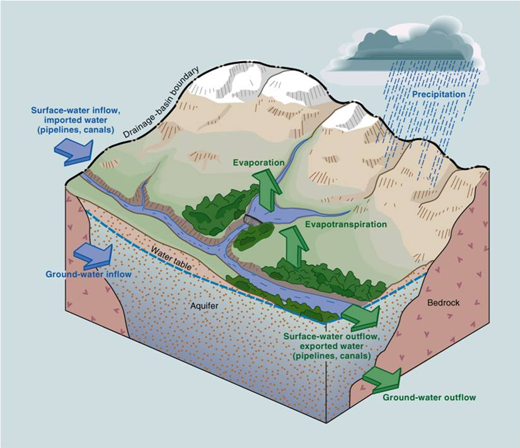
Without further ado, here’s a basic sketch of where a year’s snowpack goes…
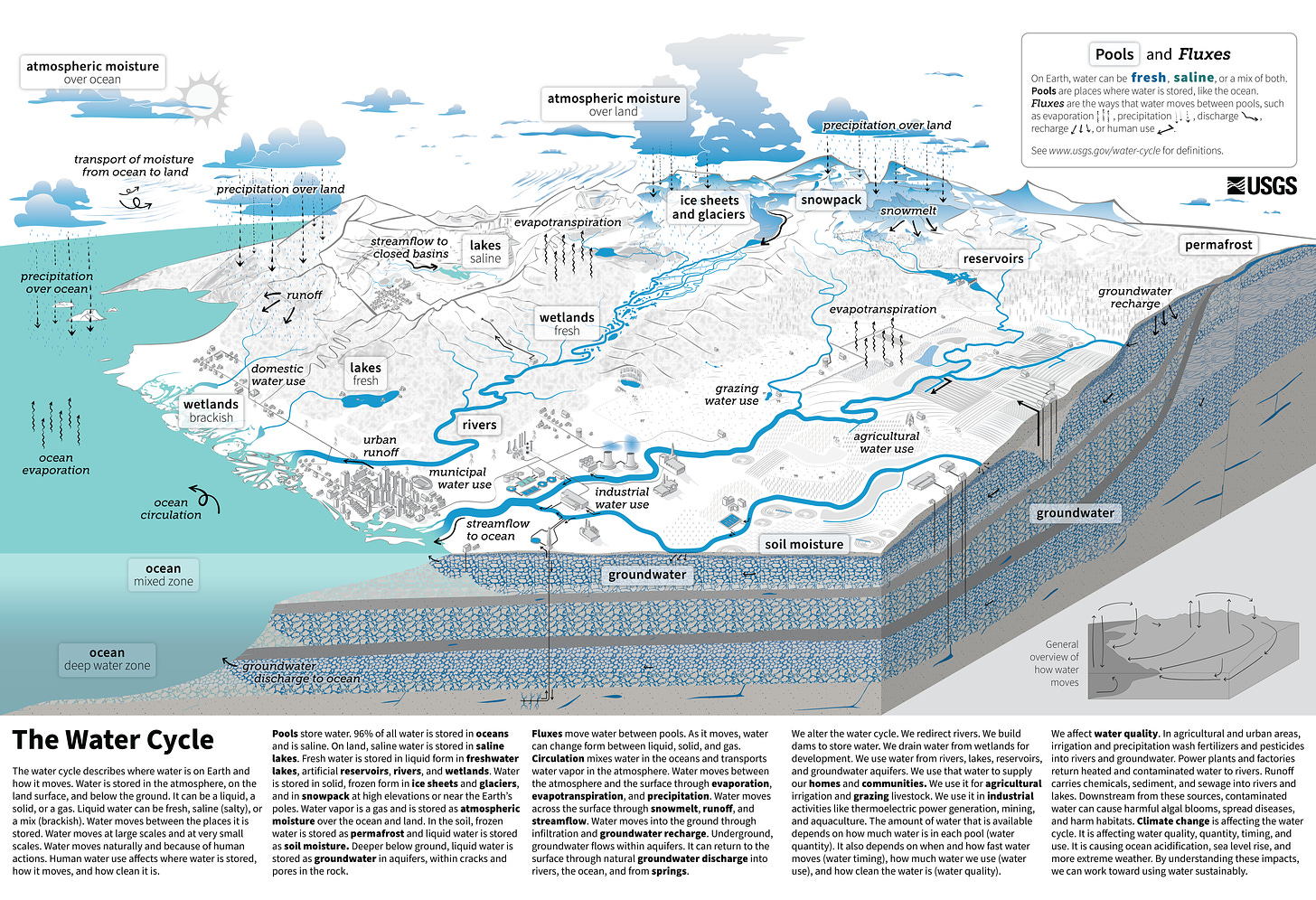
…followed by a pretty cool depiction of the entire water cycle, as posted just last month by those scions of J. W. Powell’s grand map-making vision at the US Geological Survey. The fine print below the image is best read on the USGS website, but as this is a graphic narrative, let’s save that for later, shall we? Scroll down, for our tale of dryland anomaly is about to begin!
Here’s how we got from the 1950s-era full-pool BuRec dreams of Dominy the Dam Builder, to…
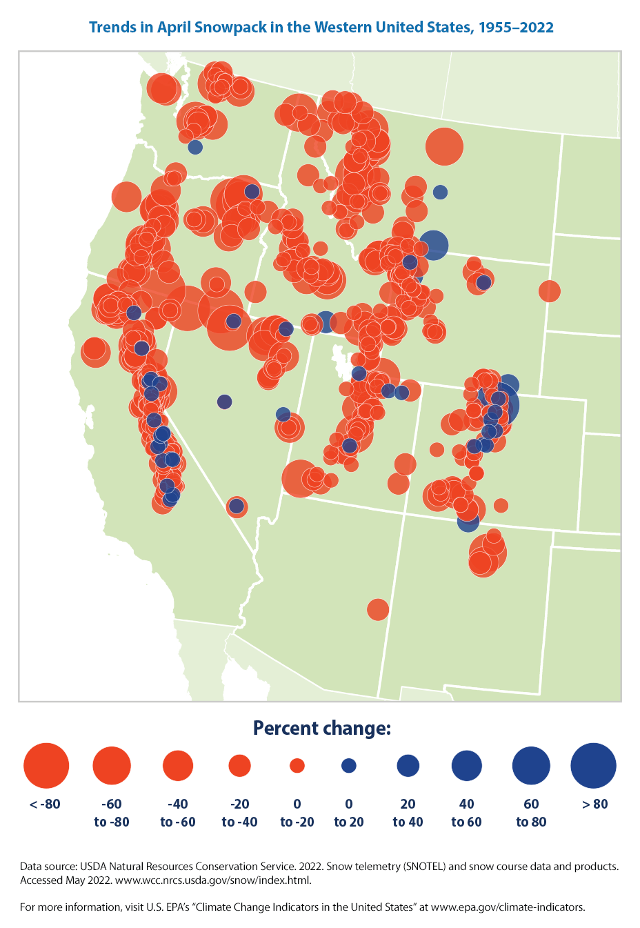
…the rather pessimistic ‘teacup theory’ analogies of recent assessments of the hydrologic future of the Interior West.
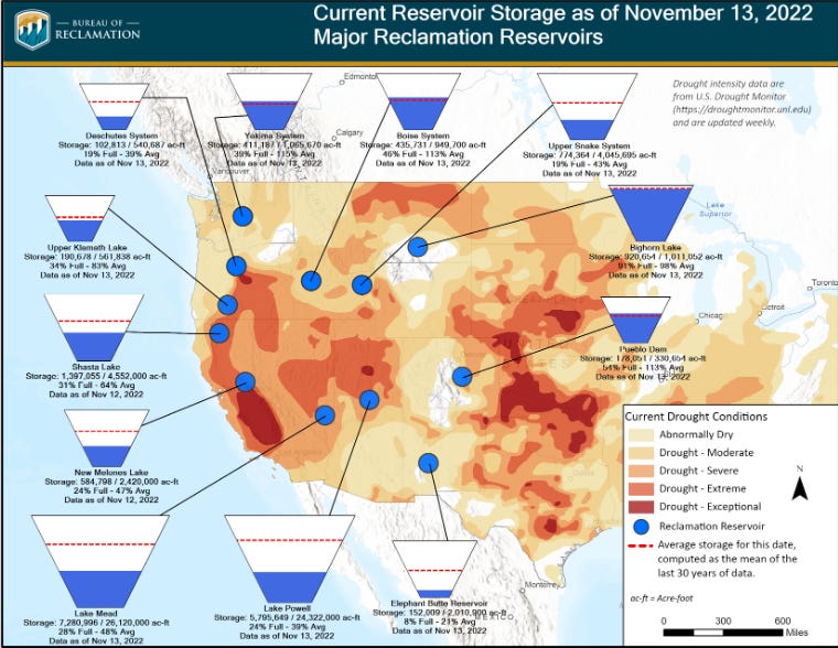
On a more optimistic note, long-time river rats like myself can now float between layers of newly exposed silt (dubbed the Dominy Formation by some geology-minded sorts with a sense of irony), as reservoir levels recede and rivers reclaim canyon bottoms. But even river rats must eat some vegetables, and river-side game animals are even less plentiful than when Major Powell and his ill-supplied band of adventurists labored down the Green/Colorado River canyons in 1869. A goodly portion of those vegetables, plus alfalfa to feed the river-side steak-n-barbecue dreams of modern day river-runners (along with much more for a burgeoning human multitude scattered from sea-to-shining-sea, and beyond to the far side of our planet) are produced from the naturally dry lands that surround the dwindling reservoirs shown above.
We turn now to transpiration, an innocuous seeming physical side effect of plants using water and soil nutrients to make chlorophyll-producing leaves, and the evaporation of moisture from bare soil and from the surfaces of rivers and bodies of water. Combined, they add up to…
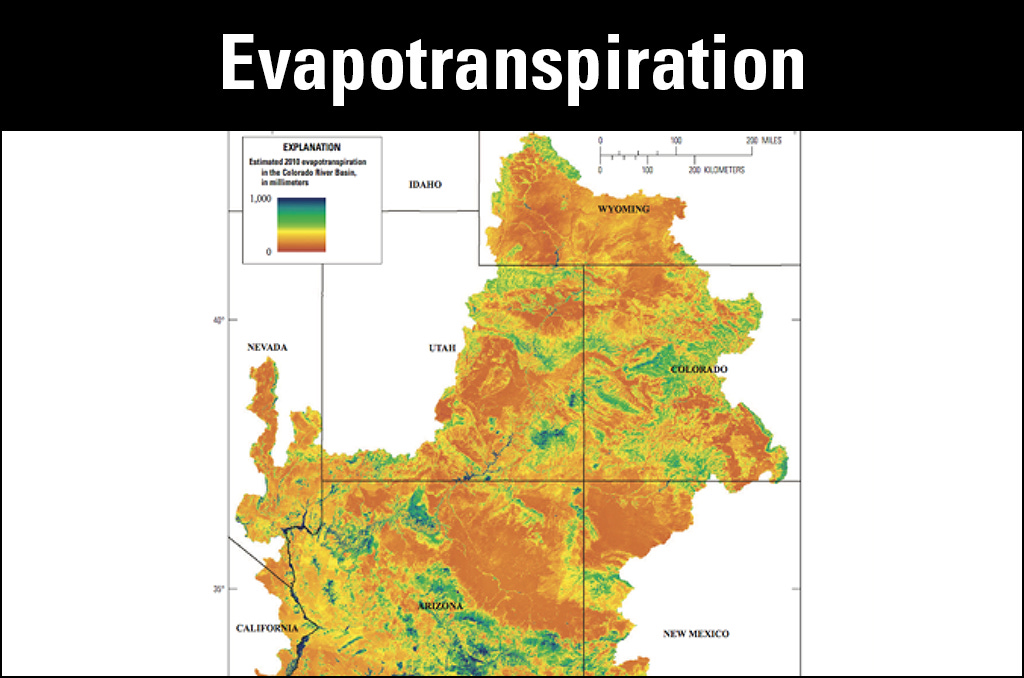
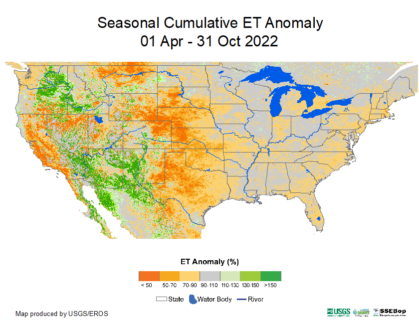
Above is the 2010 evapotranspiration (ET) rate from the Upper Basin states of the Colorado River Compact, that century-old fantasy of unlimited agriculture and population growth for the arid lands. Below is 2022’s cumulative ET anomaly from recent decades. On both maps, green means more water is returning to the clouds in the form of vapor. Shades of yellow and orange indicate dryer, and/or rockier landscapes…
Now to the physics of brewing coffee or tea, as it relates to evapotranspiration rates of crop growing in arid regions. More heat makes more steam, so as desert surface temperatures in the Colorado River’s Lower Basins creep into poached egg territory, snowmelt returns to the clouds as vapor ever more efficiently, via amply irrigated fields, golf courses, lawns, reservoirs, etc. Agriculture here…
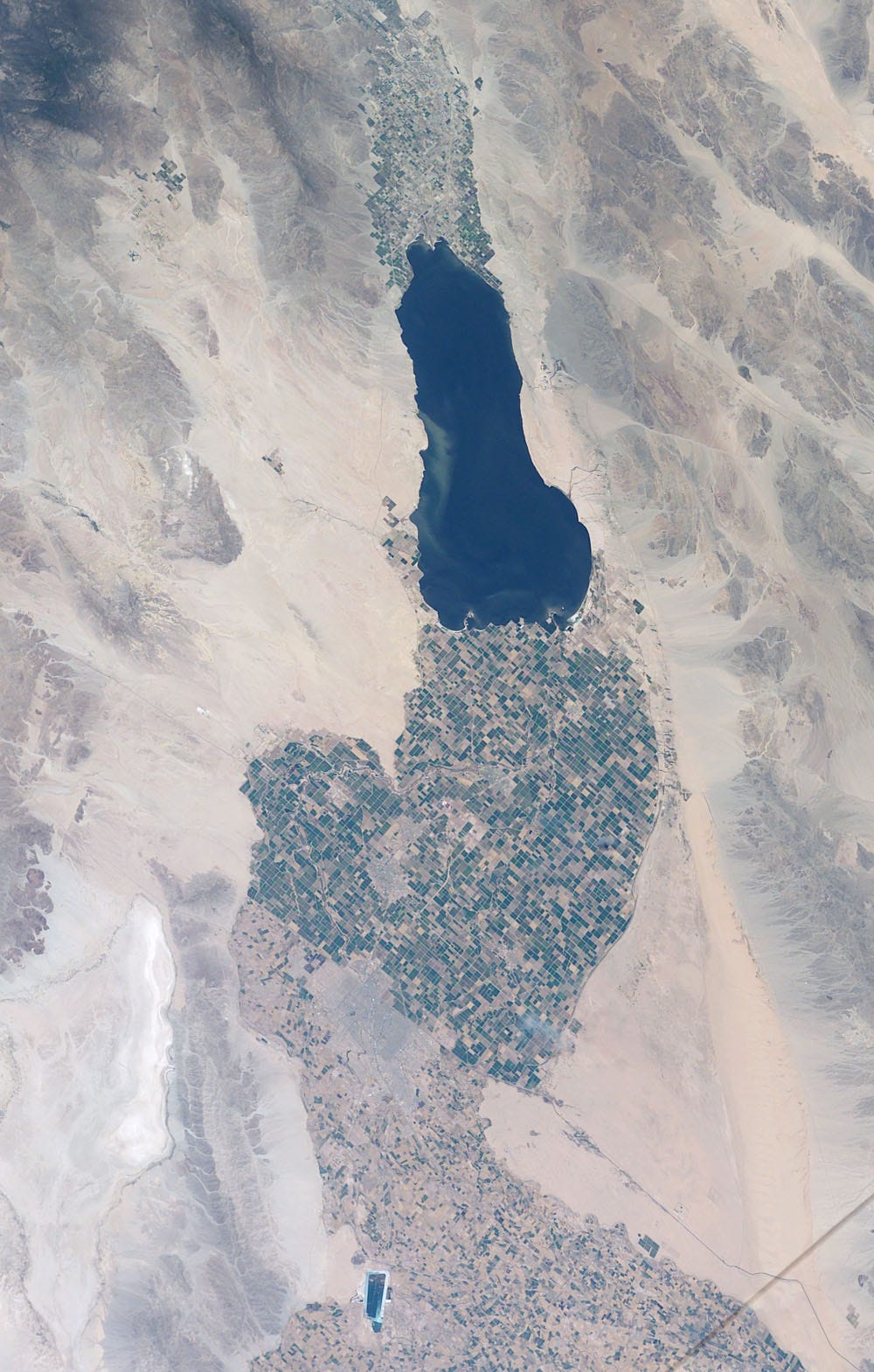
…transpires much more water vapor per acre than crops grown further upstream, near mountain peaks that collected the snowpack…
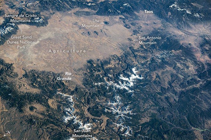
…yet most of the Colorado River Basin’s agriculture and it’s largest population centers are in lower, ever hotter regions, and much of the water banked in Upper Basin reservoirs is awaiting delivery to the Lower Basin, per Colorado River Compact terms.
In olden days of comic book heroism, here is where a climactic panel would depict a swashbuckled path through all anomaly, water law, and other foes of the one true path. But in these graphic depictions, and in ongoing negotiations to rewrite the Compact, the saga of our very human predicament is “…to be continued.”
I encourage you to explore these links, share them with others, and to tell us all what you find. Up next Cloudbusting with the Rainmakers: Adventures in Engineered Weather; until then, take care of yourself and help someone else out along the way. - B


