

“Our gifts to ourselves…”
“Our gifts to ourselves…”
A year-end appreciation

First off, my thanks to all who’ve joined me for this journey across our continent’s drylands! Your subscriptions are great encouragement, your comments and likes are being considered. Each post is a form of open-access research as I develop these story-lines, so please click the links for more information on subjects that catch your interest. I encourage you to share your thoughts and knowledge going forward — via the Comments button, or you can email me at: bfrank.waterintostone@yahoo.com.
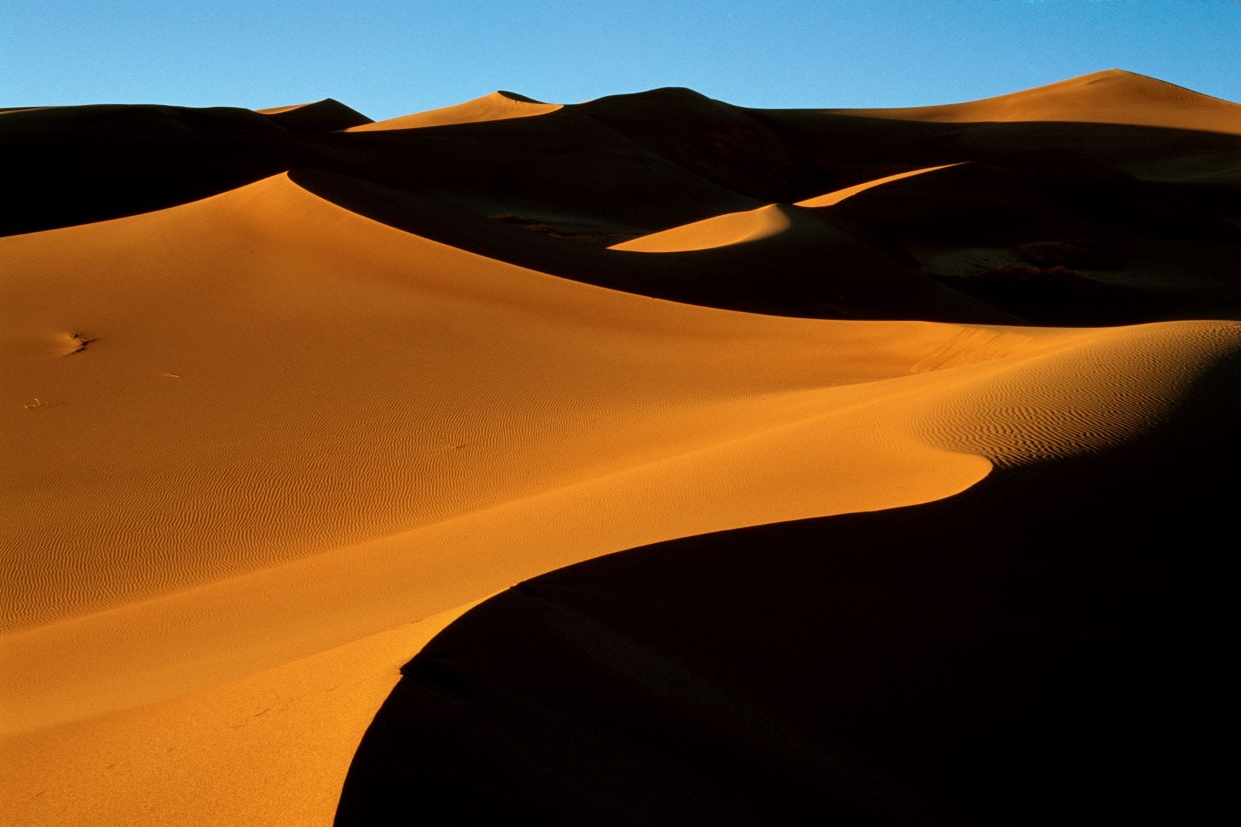
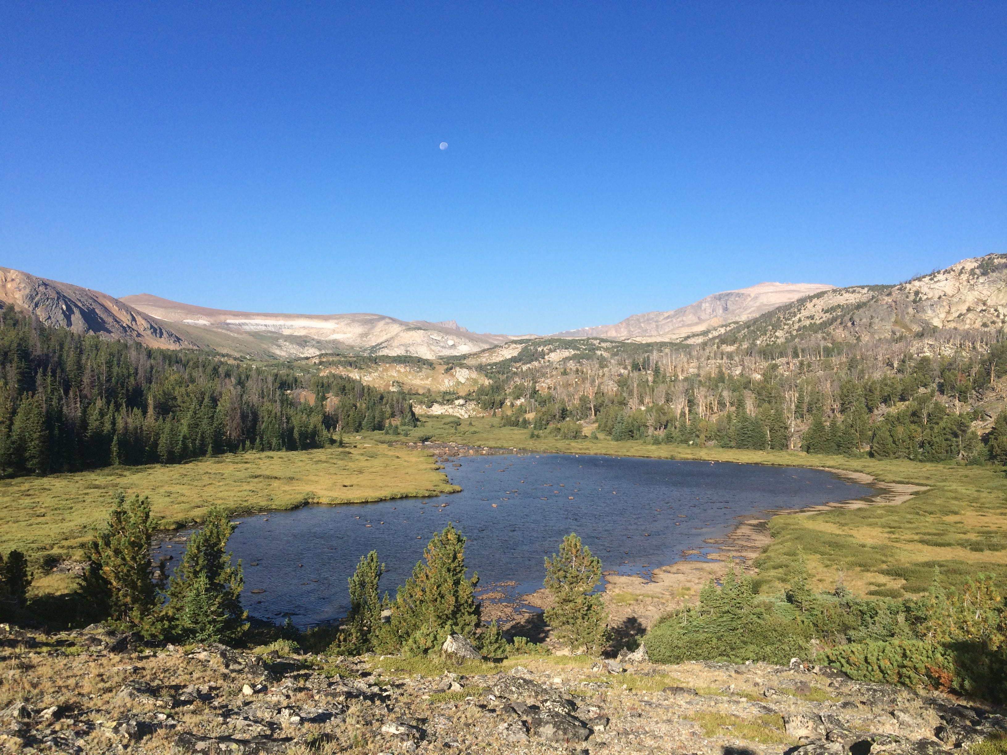
As the days lengthen, we’ll be exploring resilience and adaptation, habitat changes and consequences, species migrations and emigrations — along with our own species’ attempts to adjust, adapt, and oftentimes to ignore or deny these dryland realities. I hope you’ll be entertained, intrigued, and moved to share Water into Stone with friends and acquaintances, but for now let’s consider some landscapes that belong to all US citizens, no matter our ethnicity, skin tone, national origin, wealth status, political opinion. Public lands are administered by several federal agencies, but they are our common heritage. Though many across the current political spectrum covet, and attempt to justify, the transfer of ownership (and/or control) to this or that private entity or ‘interest group’, much public land remains to be appreciated and defended.
For many years, I followed the travels of journalist Charles Kuralt, as he sought less-told stories of life on this continent to share with viewers through his On the Road profiles of North America, and later as he hosted a televised Sunday morning news program. I adapted the concept and title of this post from Kuralt’s yearly consideration of landscapes that have been set aside — for us, and for those who will inherit what remains.
Some of these images are from the archives of federal agencies noted in the captions. As such, these are in the public domain — just like public lands, ours to appreciate.


In her 2016 book, The Hour of Land [Picador], drylands writer Terry Tempest Williams relates tales of America’s National Parks and Monuments that don’t adhere to recently promulgated stereotypes of disunion and division, grievance and retribution. Her family’s multi-generational relationship with Grand Teton National Park sets the book’s tone, a tone that rings true to my own story of living in the company of places still wild enough to surprise and humble.
I hope these images and thoughts will inspire you to further explore, and to defend the public lands near you in coming months and years. Due to recent advances in mapping technology and access, detailed information on the status and locations of public and protected lands is available, if you know where to look. The US Geological Survey’s Protected Areas Database of the United States (PAD-US) is a good place to start. Click the image below to access a highly detailed, printable map with managing agencies defined by color. Enjoy your nearby piece of our heritage, and then tell me what you find.

Up next, Preppers and Predictors: Hazard maps and resilience plans. Until then, take care of yourself, enjoy the season, and help someone out if you can. - B
Here’s a look at Charles Kuralt’s life and work, with reminiscences from colleagues.
I encourage you to seek out some less visited National Parks, Monuments, historic Parks and Recreational areas near you.
For specifics on National Forest Service administered lands, here’s an interactive map (click “Layers” to find Wilderness Areas and more).