

Flyways in the Drying West;
Flyways in the Drying West;
A (mostly) Moderate Defense of Migration Habitat

“The seasons, like greater tides, ebb and flow across continents. Spring advances up the United States at the average rate of about fifteen miles per day. It ascends mountainsides at the rate of about a hundred feet per day. It sweeps ahead like a flood of water, racing down the long valleys, creeping up the hillsides in a rising tide. Most of us, like the man who lives on the bank of a river and watches the stream flow by, see only one phase of the movement of spring.” — Edwin Way Teale, from North With the Spring [Dodd, Mead & Company, 1951]
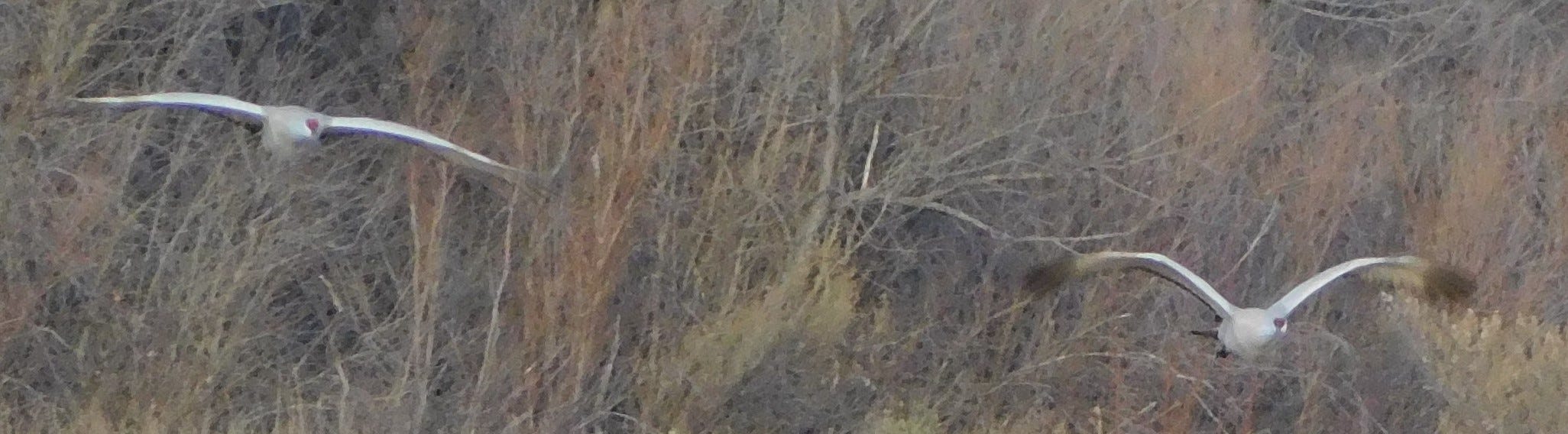
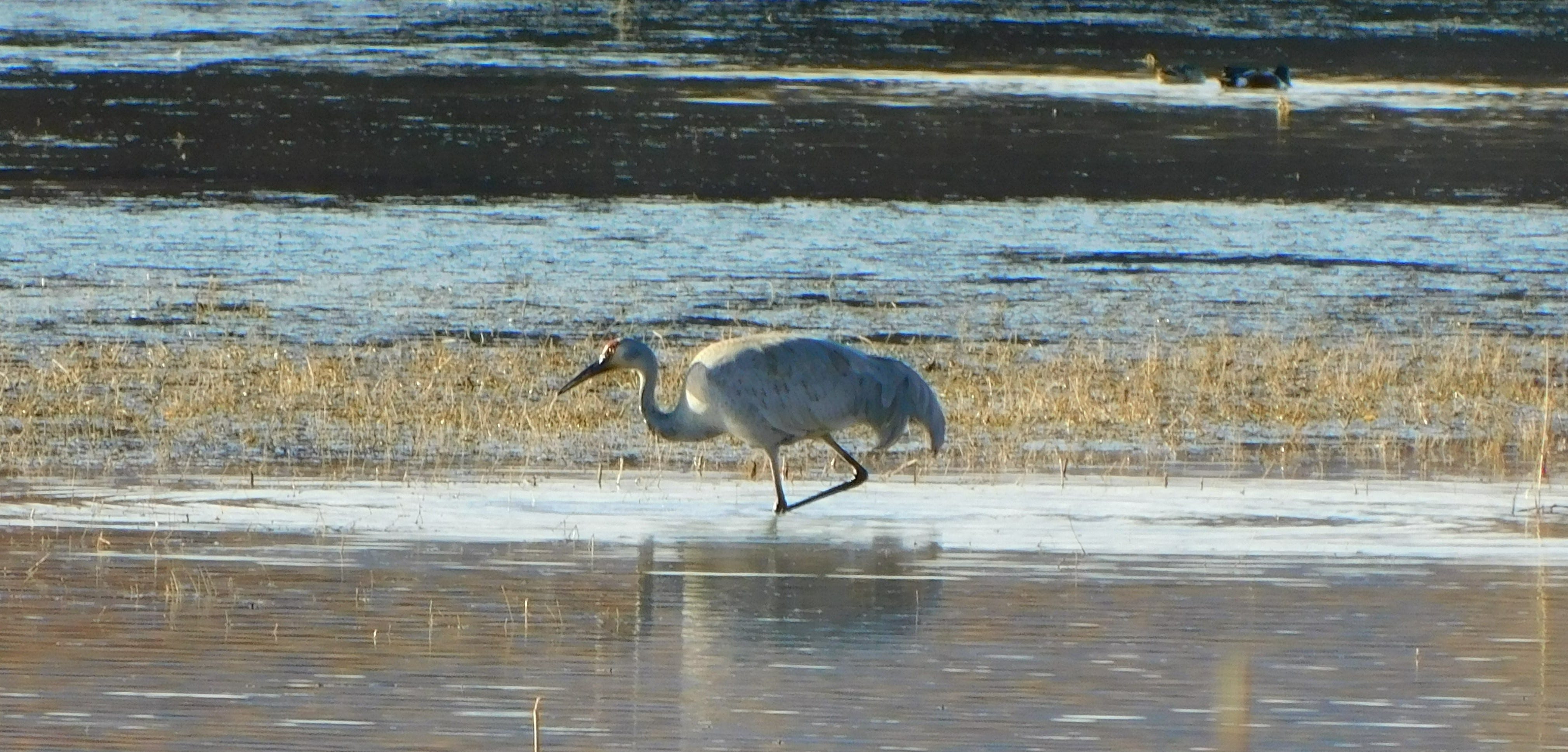
Long ago, I moved with other human migrants under tides of birds, following the ebb and flow of seasons along the Central and Pacific Flyways. In the decades since, I periodically give in to the pull of the season, and retrace a portion of a flyway…
Many migrants move in darkness. Come early morning, you might see some of them still on the wing, seeking food and a sheltered place to wait out the daylight hours. Below is a screen grab of a live, free bird migration map that uses U. S. Weather Service radar images to show seasonal bird migration patterns through a 24-hour cycle. The yellow bar shows sunrise progressing towards a concentration of migrating birds (the orange arrows show direction of flight). Click on the image to watch a real-time map, and read more details on this collaborative research effort. (Fair warning though, all of this can be a little mesmerizing if you, like me, feel an urge to join the season’s tide.)

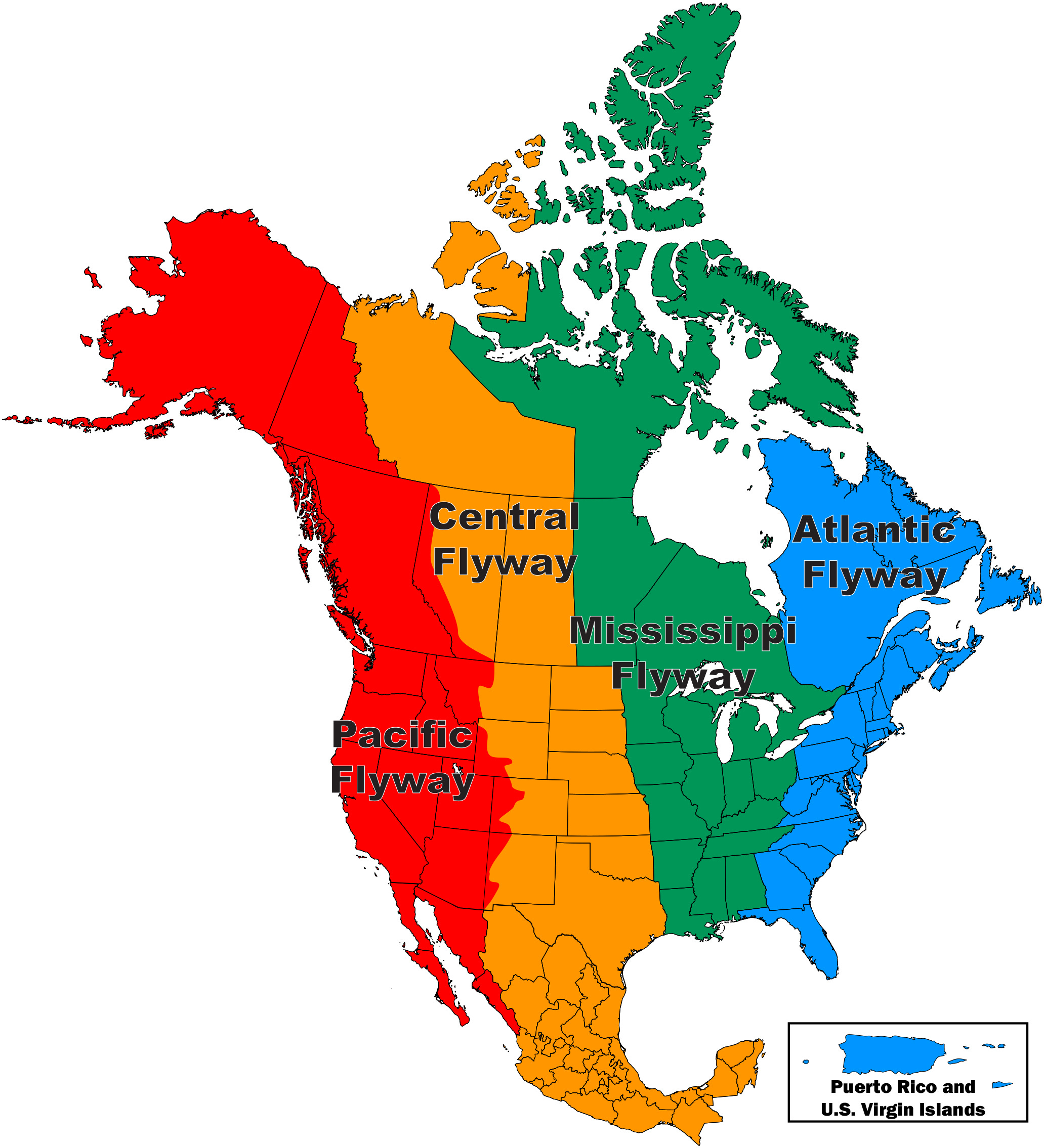
More than 500 species of migratory birds breed in the U. S. and/or Canada, with distinctive routes, methods of travel, and habitat needs along the way. To learn more about different species, and their migration routes, here’s a Bird Migration Explorer from the Audubon Society. Clicking the image below will take you to an interactive map, with various tabs for species, locations and survival challenges.

Below is a map of drought challenges, with the American West covered in brown dots, each dot linking to a species that depends on that part of the flyway as it passes through.

As human populations keep shifting from rural to wildland/urban interface concentrations all through the drylands, collapsing Dust Bowl-era farm buildings are being joined by more recently abandoned mobile homes and houses in a long journey of decay. On my recent travels through southeast Colorado, northeast New Mexico, the Rio Grande Valley, and the Colorado Plateau I breathed the dust of high plains meadows and fields lifted into the wind, passed among dead and dying wetland-loving trees and understory plants — stark reminders that average annual flows in the Colorado and Rio Grande River drainages continue to shrink from one decade to the next. Meanwhile, ever larger interests keep buying up large tracts of agricultural and grazing lands, drilling ever deeper wells that draw down local aquifers, thereby drying up small riparian areas and residential water supplies.
Though relieved by occasional wetter than usual seasons such as the one my home range is now experiencing (which always add up to raised hopes and a reduced sense of urgency for necessary changes in human water over-exploitation), we’ve entered a 3rd decade of consistently widespread drought. Buy (or rent)-to-dry bail-out schemes are becoming this century’s version of the early 1900s-era attempts to harness the always scarce water of the interior west to limitless profit, but in the back and forth among Upper and Lower Basin water planners, politicians, developers, investors, and sundry water rights holders, I read little about the ever mounting losses of viable, connected habitat for birds, insects, mammals, and reptiles.
After the catastrophic results of late 1800s-early 1900s land development/exploitation became obvious in the 1930s Dust Bowl — federal, state, and private interests developed soil and water conservation methods that have effectively preserved enough waterfowl habitat along the flyways to support plentiful waterfowl populations, even as over 2/3 of all bird species in North America face a growing threat of extinction. National and state wildlife refuges are important pieces of this mosaic, but farms, fields, forests and grasslands are just as crucial in providing food and shelter. Continuing to buy and dry this habitat to feed contractual guarantees of water, growth and profit downstream seems to me to be a short-sighted heir of the long discredited theory that rain follows the plow.
I’ll be spotlighting some habitats of critical importance to migrants and stay-at-homes alike in coming posts, with an eye for examples of climate adaptation that rise above furthering growth of human populations and profits at the expense of other life forms. If you know of such projects that you think I should cover, feel free to contact me via email: www.bfrank.WaterIntoStone@yahoo.com — but up next, another celebration of spring migration, Streaming Toward Summer, with links to some very cool website tools to help you greet (or join) some of the migrants. Until then, take care of yourself, and help some others out along your way. — B.
Here is a recent feature from Audubon about drought and migration, with a deeper look at issues I touch on in this post.
For an interesting treatment of the ‘rain follows the plow’ syndrome, check this post by another SubStack writer, Jonathan Thompson.
Though most waterfowl species are still abundant, there are concerning signs in population counts overall in recent years. For those of you ready to get fully immersed in some of the details, here are the Central Flyway and Pacific Flyway Mid-winter Survey Results for 2021, as compiled by the U. S. Fish & Wildlife Service.
Great, great post!! Another Teale reader!